Translations by gtranslate.io
Sidebar
manual:user_guide:tracks:editing
Table of Contents
Track/Route Editing
Route re-planning
- change of route progress
- route extension
- route shortening
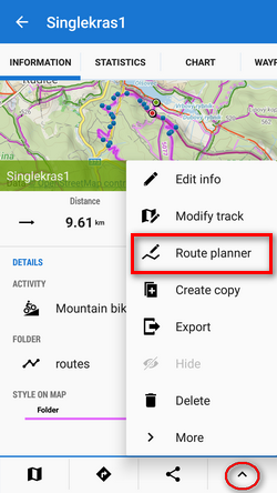
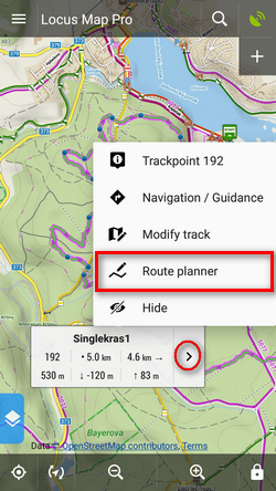
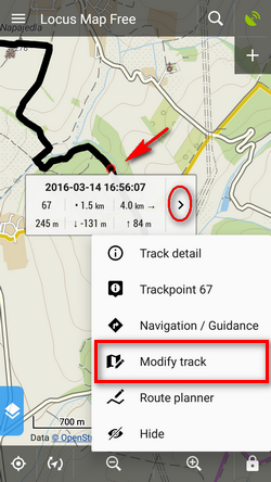
Opening the route
- from the route detail menu:
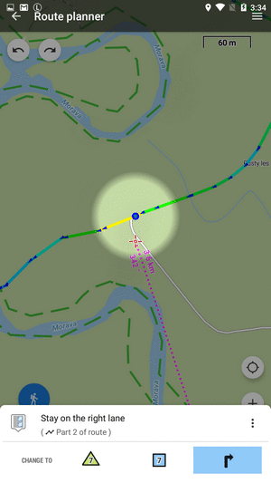
Changing progress
Drag shaping ![]() and auxiliary
and auxiliary ![]() points to re-shape route:
points to re-shape route:
If the route does not contain shaping points where you need them, tap the place of the route and make shaping point from an ordinary trackpoint. This way you can add also via points or navigation points:
Trackpoint changes into a shaping point and a new auxiliary point creates in between:
Editing navigation commands
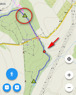
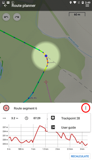
Navigation hints are added to Locus routes automatically (it can be switched off, see here >>). They are displayed as tiny blue dots in the line. When you move cursor above them, the navigation hint appears:
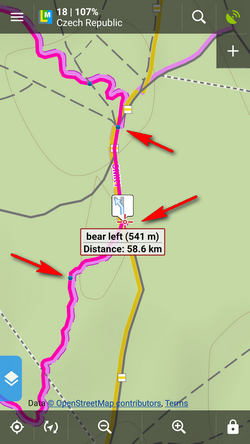
Sometimes you may want to correct these hints:
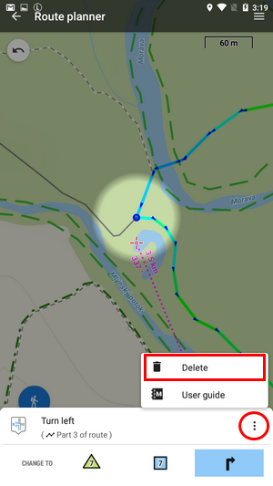
Removing
- open route in Route planner and tap the navigation point:
- select
 Remove from context menu:
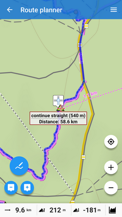
Changing
- tap the navigation point in the route planner
- tap the navigation point button
- select the navigation command:
Adding
- open route in Route planner and tap the place where you want to add navigation point
- open the trackpoint menu and tap the navigation button
- select navigation command:
Extending
Add ![]() shapepoints or via points
shapepoints or via points ![]()
Shortening
Remove ![]() shaping points:
shaping points:
- When you need to edit an imported route, it is necessary to add shaping points to it first
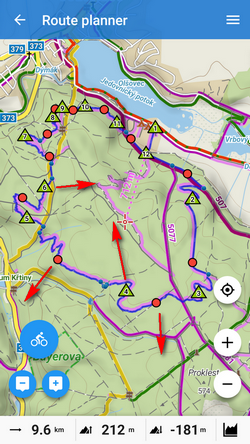
- More details about route planning in Route Planner article >>
Saving changes
Open the topbar ![]() route menu:
route menu:
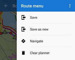
- Save - overwrite the original route
- Save as new - creates a new route, the original one stays untouched
- Clear planner - discards all changes
Track repairs
Some edits do not make changes in the route plan but rather repairs of recorded tracks. These can be edited in Track editor:
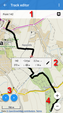
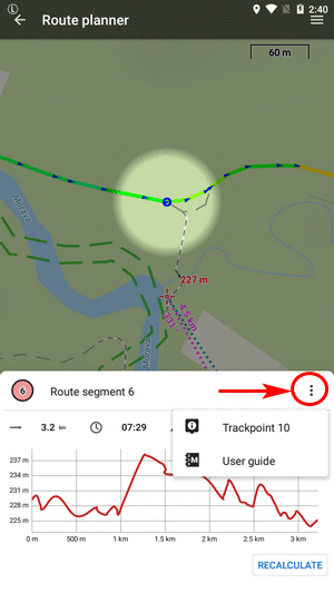
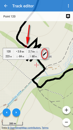
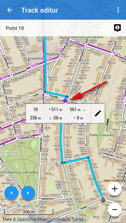
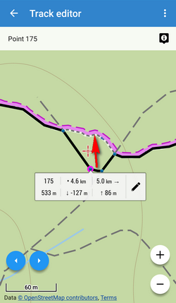
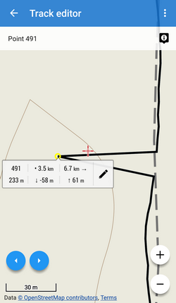
- 1 - trackpoint bar - selected trackpoint number and details
- 2 - trackpoint label - distance to end of track, to start of track, elevation and
 tools button
 - 3 - trackpoint selector
- 4 - map zooming
Track editor can be launched from the map screen:
or from he track detail screen:

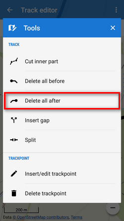
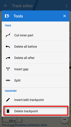
Cutting part of track/route
Inner part
Sometimes weak GPS signal causes deviations in track recording. This way you can cut the deviation out of the line:
- select place on track where to start cutting and taptools button:
- select
 Cut inner part from the tool menu:
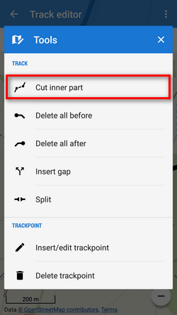
- tap the other trackpoint of of your line selection and confirm:
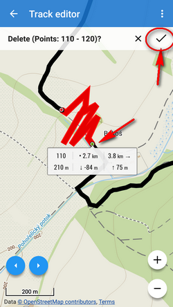
- distorted part of the track is replaced by a straight line:

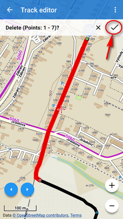
Part before
Sometimes you import a hiking route including a part driven by car to the trail head. To delete such part, use ![]() Delete all before tool:
Delete all before tool:
- tap the place on the route to which you want to delete line from its start:
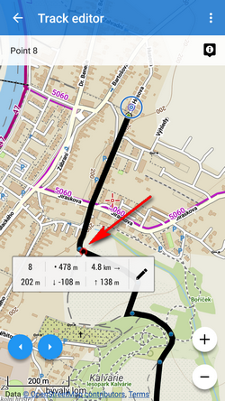
- select
 Delete all before tool:

- confirm deleting of the part from the start to your selected point:
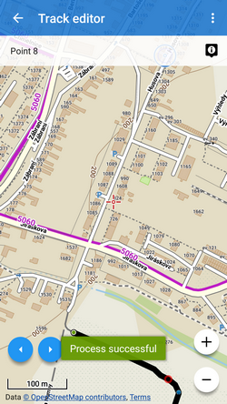
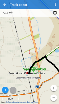
Part after
Sometimes it happens you forget to stop track recording when arriving from your trip to the train station and the recording goes on in the train. You need to remove the train part:
- tap the place of your track where you arrived at the train station:

- select
 Delete all after from the tool mnenu:
- confirm deleting of the remaining part of the track:

Inserting a gap
Imagine you record your running workout and for some reason you have to use the street bus in the middle of it. You actually forget to pause the recording. Afterwards, you need to erase the bus part from your track and leave the space empty.
- tap the point on your track where you got on the bus:
- select
 Insert gap from the tools menu:
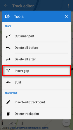
- a gap appears between selected trackpoint and the next trackpoint:
- repeat the step above until you get to the point you got off the bus and went on running:

This step can be reversed by tapping the trackpoint by the gap and selecting  Remove gap from the tool menu
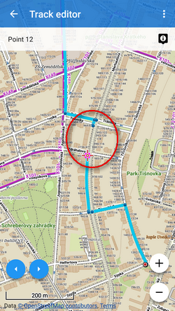
Splitting track
You can split track in two or more parts e.g. when you have multiple day track recording:
- tap the point on the track where you want to split it:
- select
 Split from the tools menu:
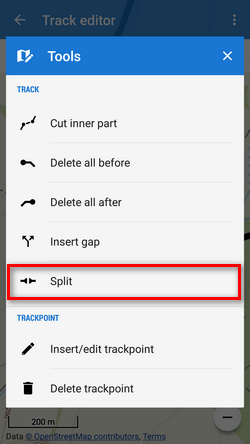
- confirm if you want to keep the original track or not:

- two new tracks are created in the same folder:
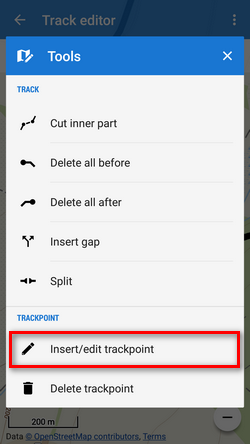
Inserting/editing trackpoints
Trackpoints are basic particles tracks are made of (resp. routepoints are particles of routes). Track/route editor enables also edits on this miniature level - e.g. when automatic route drawing makes mistakes:
- tap the track and select Insert/edit trackpoints:
- trackpoints are highlighted
 and auxiliary points
  created on part of the track around your selection:
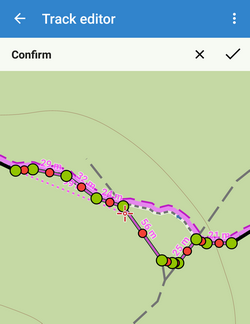
- change course of the track by moving and add new trackpoints by moving . For precise positioning Locus displays situation in a magnifier:
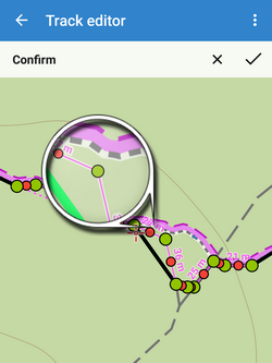
- if you want to undo, tap
 . When you are done, confirm:
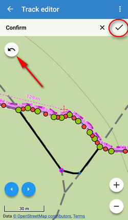
- route is repaired:

Deleting trackpoints
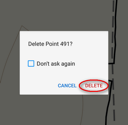
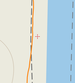
Sometimes it happens that Locus receives wrong coordinates of one trackpoint from GPS during recording which results in a “tooth” in the track. This can be easily removed by deleting the invalid trackpoint.
- tap the wrong part of the track:
- select Delete trackpoint:
- confirm action:
- repaired track:
manual/user_guide/tracks/editing.txt · Last modified: 2020/09/02 19:14 by mstupka
Except where otherwise noted, content on this wiki is licensed under the following license: CC Attribution-Share Alike 4.0 International
