Translations by gtranslate.io
Sidebar
manual:user_guide:functions:measure
This is an old revision of the document!
Table of Contents

Measuring distance&area
Measuring distance
There are three methods of measuring the distance between two points in Locus Map:
- beeline measuring - measuring of straight distance between two points
- road distance measuring - measuring distance of two points along roads and paths
- track measuring - measuring recorded distance is described in detail in track recording >>
Beeline measuring
Quick distance measuring
The quickest way of measuring distance between any two points on the map screen.
- go to Settings > Maps > Map objects > Quick measurement - check
- measure distance by touching the screen with two fingers at once. Magnifiers will help you place the measuring points precisely.

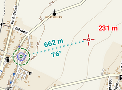
Line to GPS
Another method of easy measuring of the distance between your actual GPS position and any point on the map.
- go to Settings > Maps > Map objects > Line to GPS - check
- a line with the distance and azimuth stretches between your position and the map cursor
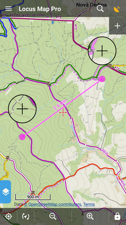
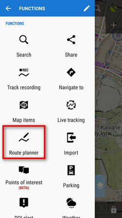
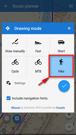
Route planner
- Menu > More functions > Route planner
- total distance between first and last shaping point is displayed in the bottom bar
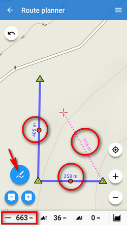
Road distance measuring
Route planner can be used for measuring road distances too:
- set some of automatic modes
- tap in the starting point
- shift cursor at the final spot
- add a route shaping point - you can add as many as you need
- a route is drawn between points along roads and paths according to your selected drawing mode
- road distance is displayed in the bottom bar:
Measuring area
Areas are measured by the Route planner too. More info >>
manual/user_guide/functions/measure.1518536867.txt.gz · Last modified: 2018/02/13 15:47 (external edit)
Except where otherwise noted, content on this wiki is licensed under the following license: CC Attribution-Share Alike 4.0 International
