Translations by gtranslate.io
Requested page doesn't exist.
Sidebar
manual:user_guide:tools:gps
Table of Contents

GPS/Compass
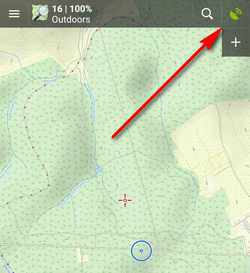
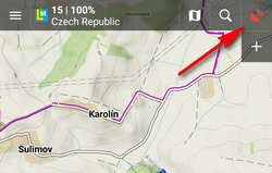
The GPS/Compass button/indicator can be placed in one of the Functions panels:
It indicates your internal GPS status:
 - acquiring of location is disabled
 - searching for location but valid location not found yet, location on the map is marked by an orange circle
 - the same as above, but Internal GPS Auto-off is enabled (see more in GPS settings >>)
 - current location is valid (GPS is fixed), location on the map is marked by a blue circle
 - the same as above, but Internal GPS Auto-off is enabled (see more in GPS settings >>)
The GPS/Compass button switches on a separate two tabbed window displaying GPS skyplot and Compass. When you hold the GPS/Compass button, a menu appears for a fast switch of GPS status.
GPS
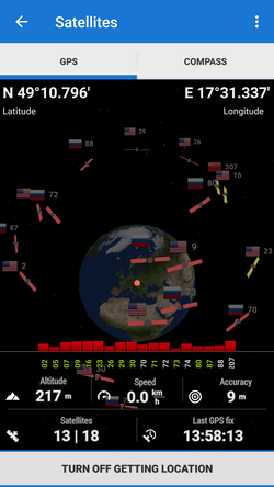
The first tab displays the skyplot - placement of monitored GPS satellites and other useful information like current altitude, speed, GPS accuracy, current coordinates, number of fixed/visible satellites and time of the last GPS fix.
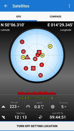
Legend
- Circles - satellites of U.S. Global Positioning System
- Squares - satellites of the Russian Glonass positioning system
- Triangles - satellites of Chinese Beidou system
- Rhombus - satellites of European Galileo system
- Color - signal quality (red - low, yellow - middle, green - high)
- Height of bars - signal to noise ratio
Tapping the skyplot or the button in the bottom switches GPS on/off.
Topbar menu
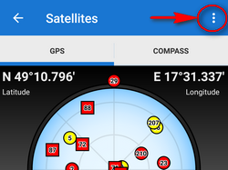
Topbar menu contains shortcuts to several items of your device sensors' settings:
- GPS simulation:
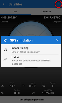
- Indoor training - turn on when you need to record your indoor workout
- NMEA - simulation of movement read from NMEA messages
Active simulation is indicated red:
- Settings:
- System settings - direct link to your device operation system settings of location
3D skyplot
The skyplot can be switched into a 3D version:
Settings > GPS&location > 3D skyplot mode - check
The globe can be enlarged by pinch zooming and rotated.
Compass
The other tab displays the compass, azimuth, distance of your navigation target and tilt of the phone. Lower line contains also fields for time to next waypoint active in navigation and declination value.
The compass ring displays current position of the Sun in the sky .
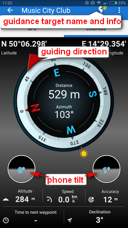
Tapping the tilting indicators opens a menu offering sensor calibration.
manual/user_guide/tools/gps.txt · Last modified: 2018/11/20 15:32 by mstupka
Except where otherwise noted, content on this wiki is licensed under the following license: CC Attribution-Share Alike 4.0 International
