Translations by gtranslate.io
Sidebar
manual:user_guide:settings:lang_units
This is an old revision of the document!

Language & Units
Language
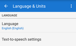 Application language setting. Changing language requires restarting application to take effect.
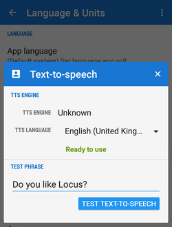
Text-to-speech settings - TTS is useful for guiding and navigation.
- TTS Engine - list of installed engines and corresponding languages. May require additional Google Play downloads in case your language is not supported.
- Locus Map
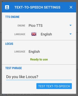 - currently set application language.
 - Test phrase - write any phrase to test your TTS setting
Coordinates
Coordinates type - select type of coordinates to display in the top panel:
World:
- Lat/Lon (WGS) - classic geographic coordinates, the most widespread
- MGRS - military coordinate system
- Maidenhead - Maidenhead Locator System
- UTM - Universal transverse Merkator
Ireland:
- OS Irish Grid - modified OSGB 1936 used in United Kingdom
Switzerland:
- CH1903/LV03
United Kingdom:
- OSGB 1936 - British National Grid
For advanced users (surveyors, professionals…) who want to use Locus Map for specific tasks there is option to define custom coordinate systems >>
Lat/Lon format - WGS Latitude/longitude format to display:
- xx,xxxxx°
- xx°xx.xxx' - used in geocaching
- xx°xx'xx.xx“ - the most accurate
Units
Length units - wide choice of default length units to work with in the application:
- metric - m, km
- imperial - ft, yd, mi
- nautical - m, nmi
Area units - select units common in your location
Altitude units - units of height above the sea level - meters or feet
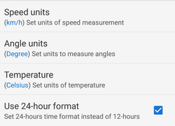
Speed units - select units common in your location - terrestrial or nautical
Angle units - select units you are used to work with
Temperature units - Celsius or Fahrenheit
24-hrs time format - use 24 hour format instead of 12-hour format
manual/user_guide/settings/lang_units.1454077009.txt.gz · Last modified: 2016/01/29 14:16 (external edit)
Except where otherwise noted, content on this wiki is licensed under the following license: CC Attribution-Share Alike 4.0 International
